More Earth appreciation news ^^
BELLA GAIA, which means "Beautiful Earth" is a multimedia audio-visual presentation expressing the deeply moving beauty of planet Earth as seen through the eyes of astronauts.Through data visualizations, dance and music performances, it tells the story of the living universe and explore humanity's challenges as we enter a new human epoch called the Anthropocene. We can see real-time display of the Earth rendered by the Uniview visualization platform.
Tuesday, May 29, 2012
Monday, May 7, 2012
Correcting colors
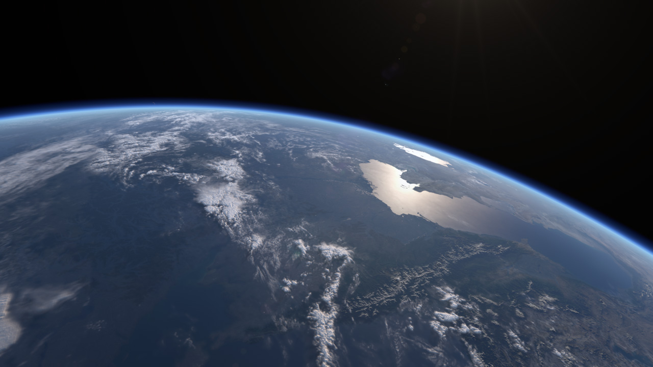
It's been almost a year since I rebooted this project (switching to Houdini and learning how to write VEX shaders), during which I have spent countless hours making minute tweaks to various shader properties in an attempt to get the right look and feel.
Alas, I feel I have pushed the shaders far enough. I've decided that it's time to apply color correction and adding effects in post to bring the final look home. At times it seem the changes I keep making are too miniscule to be even noticeable, but then again, I find it hard to put things down as long as something doesn't look right. The problem is - something always look out of place :(
Anyway, I constantly remind myself that this project is a learning process, and ultimately worth the effort at least from the educational angle ^^;;
Thursday, April 12, 2012
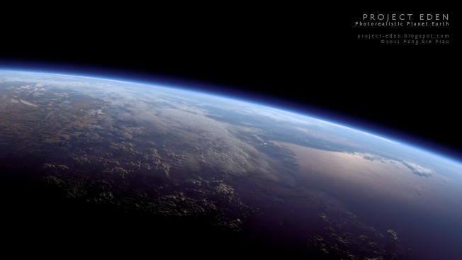
Good Morning Eden!
After weeks of re-working the VEX shaders, I am finally back on track. Here are a sequence of WIP shots (dated 27 Mar) highlighting one of my initial goals of the project - to recreate a sunrise from space sequence:


At first glance, the shots look similar compare to my early versions (created using Maya and After Effects compositing trickery in 2010), but believe me there is a world of difference, especially when things start moving. If you scrub through the sequence, you can see a hint of atmospheric scattering at work as the sunlight penetrates the atmosphere.
Naturally, I will have to add in the Sun with accompanying flares and effects during post-production in the eventual final version.
Sunday, March 25, 2012
Seas and skies
In the last post I mentioned how my shaders crashed under the new version of Houdini. I'm glad to report that I have re-worked them to work with H12, and in the process deepened my understanding of VEX shader networks. I've also managed to remove the rendering artifacts and shader errors, mainly by not assuming that unconnected inputs will have the correct default values applied. Subsequently, I have also refined various aspects and added new features to my Earth shaders.
The two most significant additions are the simulation of forward scattering in the atmosphere and anisotropy in the specular highlight of the ocean, as seen in the following work-in-progress snapshots:
The two most significant additions are the simulation of forward scattering in the atmosphere and anisotropy in the specular highlight of the ocean, as seen in the following work-in-progress snapshots:
 |
| The atmosphere scatters more light as the Sun gets behind it, an effect attributed to Mie scattering of light by particles in the air |
 |
| The specular reflection of the Sun is stronger at more glancing angles, a behavior called the Fresnel effect. The shape of the highlight also elongates as the Sun nears the horizon, mimicking how the Sun reflected in the ocean looks during sunsets |
Tuesday, March 6, 2012
Progress update
Just last week, Side Effects Software launched Houdini 12 and it's full of cool bells and whistles. I downloaded the Apprentice version and did a quick test with my Earth scene, expecting rendering speed improvements but my shaders just keep crashing the Mantra renderer. More on that in a later post...
Meanwhile, here are the latest updates with NASA photos for comparison. All are Houdini 11 renders with only exposure and gamma adjustments, mild sharpening and no color correction, down sampled to 8-bit JPG from 32-bit EXR renders.

Let's check the baseline I set in September 2011:
1. Accurate proportions - approximated using equatorial and polar radii
2. Axial tilt - this is a no brainer ^^;
3. Terminator reddening - faked
4. Atmospheric scattering - faked
5. Volumetric clouds - faked
6. Displacement mapped topography - done
In addition I've also implemented:
1. Location sensitive direct sunlight and ambient lighting colors (sunset lighting at the terminator)
2. Faked atmospheric refraction of sunlight causing the terminator line to shift back a few degrees
3. Atmosphere with altitude-based density falloff (non-physically based)
4. Specularity for inland rivers and lakes
5. City lights for night exposures
I'm happy with my progress considering I have no shader writing skills and very little Houdini experience prior to taking up this project. Still, it's a long way to go before the closeups can look convincing.
Meanwhile, here are the latest updates with NASA photos for comparison. All are Houdini 11 renders with only exposure and gamma adjustments, mild sharpening and no color correction, down sampled to 8-bit JPG from 32-bit EXR renders.
 |
| For the more observant, those tiny white dots are a strange rendering artifact which I have yet to figure out how to remove :( |
 |
| This is a closeup of the above shot. It may not be obvious, but the land, clouds and atmosphere are lit with sunset colors near the terminator |
 |
| NASA photo |
 |
| Still in the process of balancing colors, but I'm reaching a point where setting the right exposure alone allows me to match different reference photos without the need for much color correction |
 |
| NASA photo (Apollo 11) |

 |
| NASA photo (Apollo 11) |
 |
| I drastically reduced the amount of cloud coverage. Remember all my data is based on NASA's BMNG 2005 release, and they have tons of clouds everywhere. I need new data and a new way of implementing atmosphere and clouds ^^;; |
 |
| NASA photo |
1. Accurate proportions - approximated using equatorial and polar radii
2. Axial tilt - this is a no brainer ^^;
3. Terminator reddening - faked
4. Atmospheric scattering - faked
5. Volumetric clouds - faked
6. Displacement mapped topography - done
In addition I've also implemented:
1. Location sensitive direct sunlight and ambient lighting colors (sunset lighting at the terminator)
2. Faked atmospheric refraction of sunlight causing the terminator line to shift back a few degrees
3. Atmosphere with altitude-based density falloff (non-physically based)
4. Specularity for inland rivers and lakes
5. City lights for night exposures
I'm happy with my progress considering I have no shader writing skills and very little Houdini experience prior to taking up this project. Still, it's a long way to go before the closeups can look convincing.
Friday, February 10, 2012
Thursday, January 26, 2012
Blue Marble 2012
Just 2 days ago, NASA unveiled a new Blue Marble "photo" of the Earth taken on Jan 4, 2012 by the newly launched Suomi NPP satellite.
Satellite photos are not captured in the same way as regular optical or digital cameras. What happens is that light from various bands of wavelength are captured by separate sensors. The data is then selectively composited in a way that would show "true colors" as they would appear to the human eye, e.g. taking the red, green and blue wavelengths and discarding non-visible wavelengths such as infrared. During the compositing stage, color correction can be done to remove the blue tint cause by atmospheric scattering of light to get the vibrant, natural colors like we see in this new NASA image.
To get high resolution imagery, the satellite must have low orbit, which means it will not be able to "see" the entire Earth in one picture frame. Instead, the sensors can only capture a small area of the Earth's surface at a time. As the Suomi NPP is a polar-orbiting satellite, it circles the Earth in a north-south orbit along the longitudinal lines, building up swaths of the Earth's surface as it orbits. Each orbit create a vertical strip of information. A global map can be stitched together when the entire surface of the planet has been covered in this manner.
Anyone who has stitched separate photos into a panorama will know that the process involves fixing perspective distortions and lighting inconsistencies. In any case, the completed map must then be projected onto a sphere to look like the Earth as viewed from a distance. Very few man made spacecraft has travelled this far away to be able to view the planet in its entirety. Even the ISS and space shuttles orbit closely at only 300-500 km above the Earth's surface.
Regardless of the technical manipulations necessarily to achieve the image, it is highly detailed and stunningly beautiful ^^
Subscribe to:
Posts (Atom)